(June22– written by Dave)
51 Miles – 3,865 feet climbing
Before we talk about today, we have to say a few things about the Baker Bay Campground. By 10PM and throughout the night it was near silent. In fact, if we hadn’t been there for the late afternoon and evening hours, we would almost say it was pleasant. Those “middle” hours however, cost a 5-star rating. It wasn’t unpleasant. Perhaps a better description would be shockingly entertaining.
Picture a packed water park on the Sunday afternoon of a 3 day weekend. There was too much skin on display, much of it overly red. All the kids were exhausted, to the point of not wanting to move but being too tired to stop. And the parents, they were ready to be home yesterday, using very “colourful” language to try managing the kids, load the cars and get their various boats and pully things out of the water. It was pretty wild. Then at dusk, the day-use park closed and poof, it the show ended. Sorry, no photos, too overly voyeuristic.
We sat at our site above it all, feeling that we should be paying someone something for the pure entertainment value. We were just glad we didn’t have to help rescue anyone drowning at the boat ramp. And to think, this is an alcohol free park. We couldn’t imagine what would happen if a few cases of beer got added to the mix.
Anyway, it was quiet overnight and beautiful this morning. We enjoyed the silence.
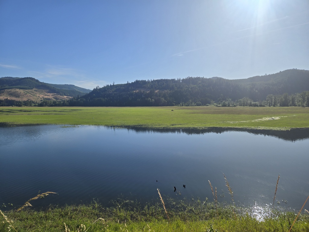
I was a little worried about today’s ride. We managed to do it but parts were hard. We had a cruisy first 9 miles along Row River Road and some more of the cycle path. There was near zero traffic. In fact, we had almost no traffic all day. I counted 5 cars in the first 5.5 hours until we pulled on the slightly busier Hwy 138.
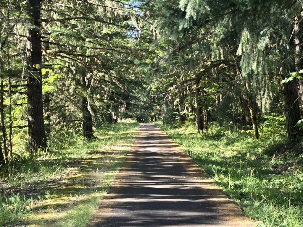
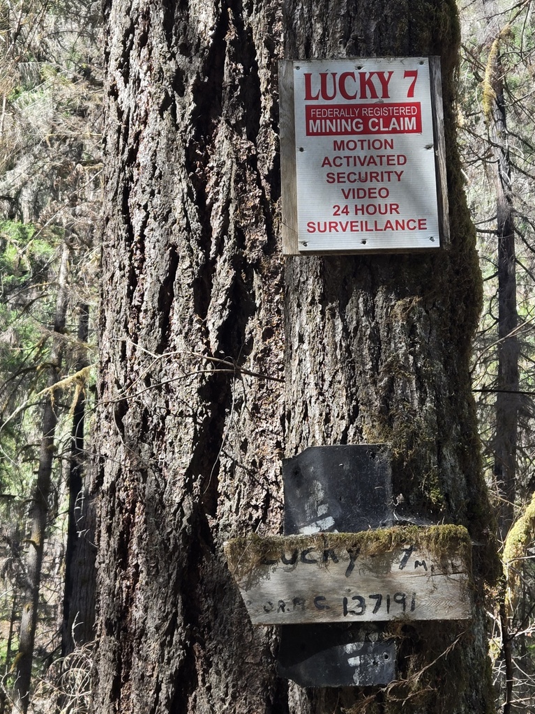
From Mile 9 to Mile 24 we climbed up Sharps Creek watershed. We knew that eventually, we’d have to climb 3,500 but the climb at the bottom was really gentle. Almost too gentle. We knew we’d pay for easy bits early with harder bits later. And pay we did. The last 6 miles were mostly over 10% with some pinchy parts over 12%. Nancy declared that “this road is too steep for touring” but we somehow we made it. At 24 miles we reached the top.
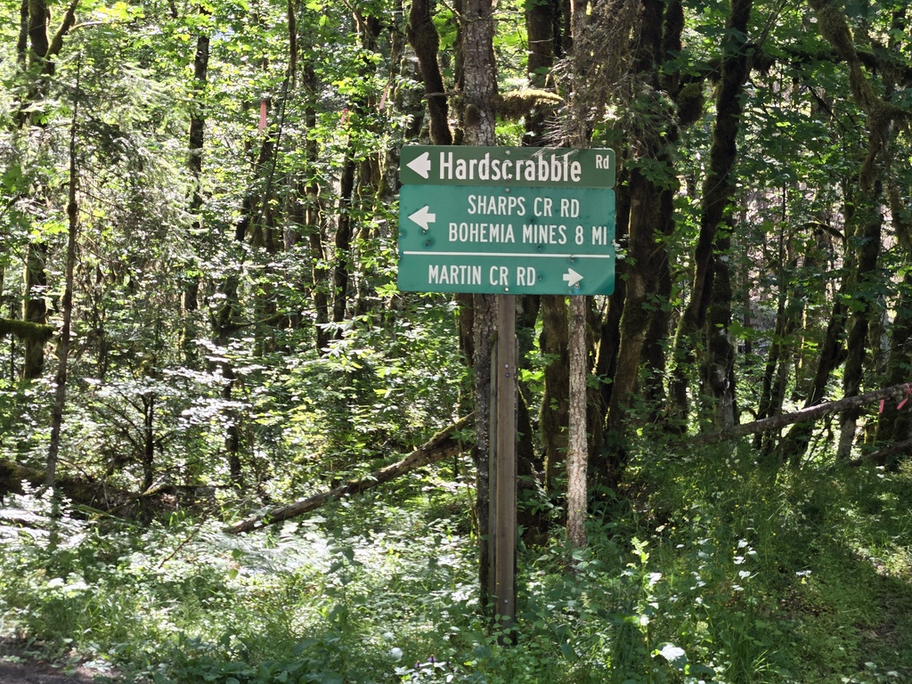
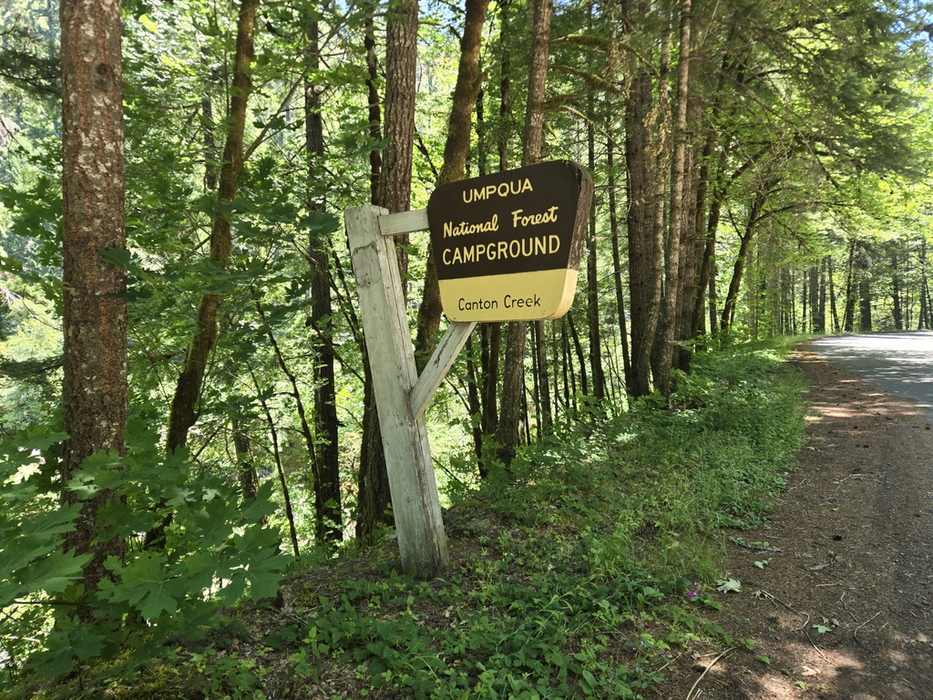
From the top we had a great mostly coasting 17 mile downhill. It’s a shame to give all that altitude back as we go higher tomorrow but neither of us was whinging. The only real issue was nearly running out of water. We were saved at the bottom of the downhill where the good folks at the USFA have recently added some spring fed water taps at the small Canton Creek campground. There were no ‘Not Potable Water’ signs anywhere so we figured we’d chance it and filled up our bottles. No ill effects so far! That actually seemed like a nice campground, with shady sites and flush toilets. There were a couple of available and we were tempted, but we wanted to make some headway on tomorrow’s mileage so we kept going.
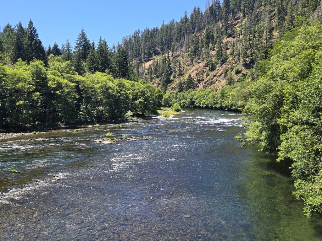
From here we joined Hwy 138 and rode the last 10 miles up the Umpqua River to our campsite at Umpqua’s Last Resort. We had a helpful tailwind going up the canyon and the gorgeous Umpqua River almost made up for the few pinchy bits where we had to wake up tired legs. We rewarded ourselves with ice cream and cold drinks at the Dry Creek store before coming over to the resort next door.
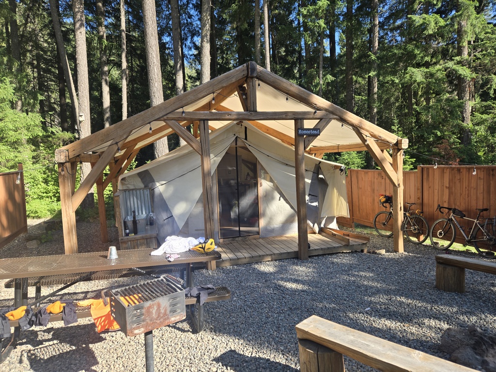
It was 100 degrees climbing up the Umpqua this afternoon so it didn’t take much for Nancy to declare an “upgrade night” and book us into a glamping tent with some fans. It is still a canvas tent that’s been sitting in the sun so it was pretty toasty inside when we arrived. We’ve been sitting with cold facecloths on our heads the remainder of the afternoon but it’s starting to cool down now and Nancy’s found a shady spot out on the grass to try to cool off. I’m thinking about dinner with tonight having a bonus of only canned protein – no need to worry if we’ll survive dodgy raw chicken tonight.
Tomorrow we have to climb up over 5,000 feet, up to Diamond Lake. We are currently at 1,800 feet and overall, there are some 4,000 feet of climbing on the agenda. We’ve ridden this road before on the way to Argentina and I know that we can do it. Nancy has mentioned that we were younger back then so there is that. Another hot day is forecast so we’ll try to make an early start and get some climbing done before the heat gets us.

Wow. You two are tough. The only way I’d do that is an E bike or a car! It looks pretty there! I hope you got a good rest for tomorrow! Happy climbing 💕💕💕 Sent from my iPhone by Inge Costa
>
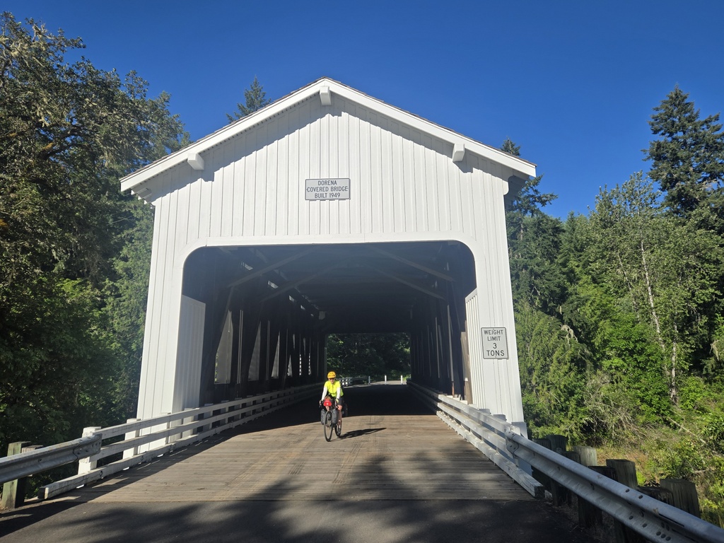
What is your route? I won a road race(the only one) at Dorena Lake in 1994. Hope you get all your climbing done before it gets really hot.
Never mind. I found your first post for this trip.