(July 19 – written by Dave)
We are enjoying our break here in Huaraz. Sleeping and breathing was a little hard the first night but our bodies have adjusted pretty well. We go over a pass that is about 16,000 feet on Sunday so getting to the point that 10,000 feels normal was a good idea.
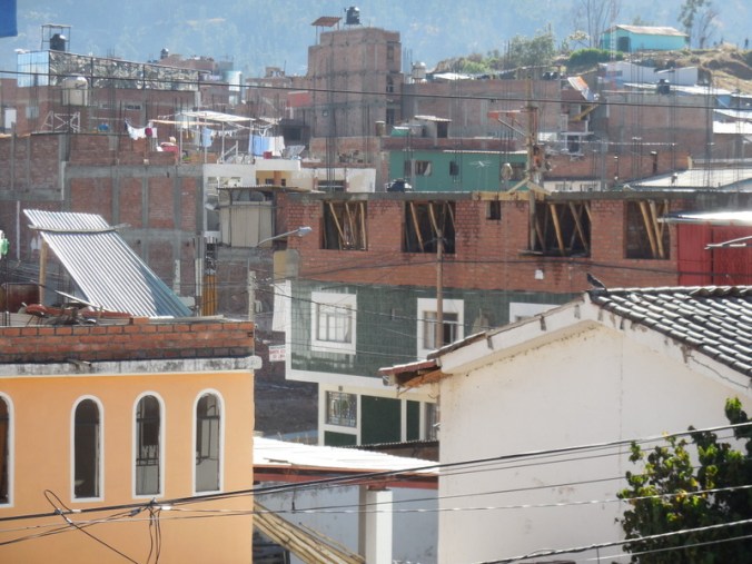
Huaraz is an interesting city with a sad past. The architecture is a bit of a mixed bag of ramshackle, new and still being built – but all for legitimate reason. Back on May 31, 1970 an earthquake of 7.8 struck just off the coast of Peru. The earthquake causes several massive landslides in the mountains around the valley we’ve been travelling in for the past few days. The town of Yungay that we rode through on Tuesday was completely buried – killing an estimated 25,000 people.
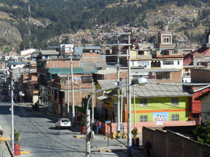
Huaraz – you won’t call it scenic
Ditto

Huaraz wiring – to be fair, like wiring in many developing countries
Here in Huaraz it was estimated that 90% of the buildings were destroyed and an estimated 10,000 people died. Compounding the disaster, the PamAm Highway was severely damaged making it difficult for disaster and humanitarian aid folks to reach the area. Eventually Huaraz was rebuilt but in truth, that process is still going on today. Remarkably, the town of Yungay was also rebuilt, but in a new/safer location. The earthquake is considered the worst natural disaster to ever strike Peru and May 31 is a national day of remembrance – the Natural Disaster Education and Reflection Day. Most schools have earthquake drills and services on this day. There is no “old colonial” area in Huaraz but this is easily forgiven when you learn about the earthquake.
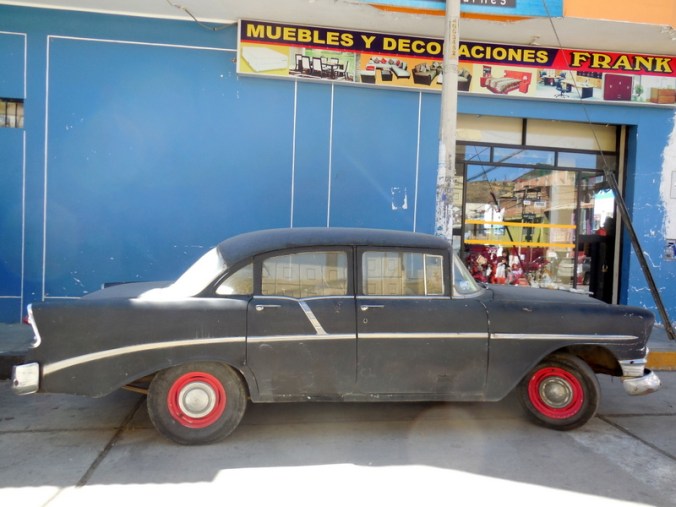
Some how, this guy survived the earthquake – it hasn’t moved since we’ve bee here however
While in 1970 Mother Nature took a massive toll on the region, she also gave the area an amazing resource in the Cordillera Blanca Mountains. Today, these mountains form the backbone of the region’s ultimate recovery. Huaraz is a beehive of outdoor shops and trekking companies. The town is full of tourists buying equipment, renting gear, eating in restaurants and staying hostels. We haven’t seen this many gringos since we left the USA. I will admit that not having a beard, facial stubble and/or a man bun is given me a bit of an inferiority complex here. The trekking crowd has a certain rugged look that even though we’ve been travelling for well over a year, I have yet to master.
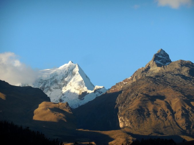
Mother Nature’s gift to Huaraz – from our room at sundown
While Huaraz is not large they have one reasonably well stocked bike shop- Montañas Mágicas Bike Center. It’s really more of an outdoor store with bike parts. We were able to buy replacement brake pads for our bike (Avid BB7) and new chains. We don’t technically need pads yet but we will further south and will probably not find them beyond here. We got the shop to give our bikes a complete once over – most things I can do myself but it is always good on a long trip to have a professional look at things – and at $10 per bike, it’s a bargain.

Mid-morning on Wednesday – why not have a parade – we don’t know the real reason…
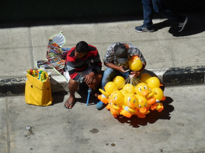
Still a lot of balloons to sell at this parade
Since arriving in Colombia we’ve been burning regular gasoline in our camp stove. The stove is designed to do this but with gasoline the fire is not as hot, there is a gasoline smell and your pans turn black – we prefer white gas. They don’t sell white gas in Colombia or Ecuador because it can be used in the refinement of cocaine. We were not sure what we’d find in Peru but are happy to report that white gas, known here as bencina, is widely available in Huaraz in the outdoor shops – and the outdoor folks tell us that we can get it in hardware stores as we head further south. We should be able to use white gas the rest of the trip.
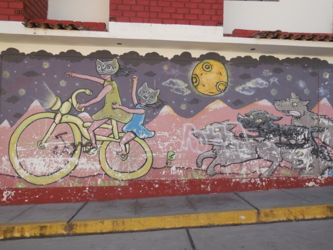
Heavily worn street mural that reflects our life on the road in much of Latin America
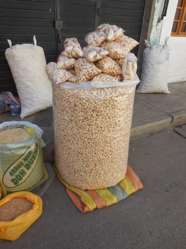
One massive bag of wheat puffs – I have no idea who would buy this but a lady was selling it on the street

Cookies in Hauraz – yes we ate them all!
Huaraz was also the end of our mapping/route planning. So we’ve spent a good deal of time working out where we go from here. Peru is big, we are probably close to a month from Cusco (and Machu Picchu). We’ve mapped out the next couple weeks heading down the centre of the country. (Senior editor’s note – hmm, I think that’s the royal ‘we’… I don’t think Dave has looked at the map since we’ve been here. Thankfully I have got us mapped through to the next ‘big’ town, about 9 days ride from here. Okay, okay, he has been doing other things…)
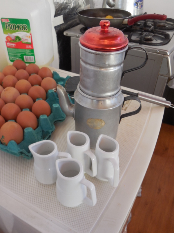
Mystery solved! We’ve been wondering how they make the mini coffees that you are supposed to add water and milk to – it’s a stove top percolator of sorts
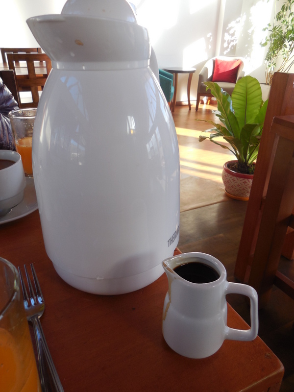
Coffee is often served this way in Peru – carafe of hot water and mini shot of coffee
We are now using the mapping application Komoot almost exclusively. We’ve previously used MapsMe, Google Maps and iOverlander. For context, we get a phone SIM in every country – meaning we have coverage wherever there is a mobile signal, and of course wherever there is free WiFi. In Latin America so far we’ve had worsening mobile signal as we’ve gotten further south – so our normal mode of travel is offline. For the benefits of other travellers, I’ll comment at the end of this post with a quick Pro/Con of each tool – from our point of view, your actual results (and mileage) may vary.
We’ll be in Huaraz for another two days. We depart on Saturday. Tonight we have dinner with Philipp and Kathrin who are scheduled to leave tomorrow. Our hotel here, the El Jacal Backpackers has worked out great. I’m not really sure why they call it a backpackers – it’s not priced like one and it is much nicer than the name might imply. The owners have been very helpful and we get a nice brekkie every day. We are expecting much lower standards for the coming couple weeks – some wild camping and some hostels of much lower standard. Oh well, we’ve heard that the upcoming scenery is great – that should make the hotels a little easier to accept.
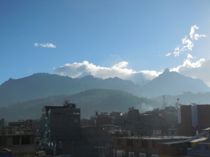
Photo taken from our brekkie table – life could be worse…
Mapping tools we use:
Komoot
Pro:
- Works offline if you download the map/route when you are connected
- Shows elevation profile
- Shows a fairly accurate gain/loss per route – both up and down, not net difference (unlike MapsMe)
- Allows you to select your method of transportation – hiking, mountain biking, touring bike, road bike and will adjust the route accordingly.
Con:
- If you change routes during the day and you’re offline, you cannot reroute
- Sometimes shows tunnels or overhanging canyons as 45% degree climbs when they aren’t
- It does show the road surface (unpaved, paved, asphalt, single track, etc) but it is often not very accurate.
- Doesn’t show the level of detail in cities and towns that MapsMe and Google shows – eg hotels, restaurants, etc.
Google maps
Pro:
- Works offline if using phone GPS function and you’ve downloaded the relevant map while you are online
- Shows elevation profile in AU/Canada/USA if you pick bicycle for mode of transportation
- Bicycle routes chosen in those countries are generally good, without weird paths on roads that don’t exist
Con:
- You need to download maps for offline use
- No bicycle route availability in Latin America so no elevation profiles available. You can use sister tool Google Earth to get profiles of proposed routes in Latin America but it is slow and complicated to use for such a simple function
- Over estimates altitude gain/loss by about 33% most of the time
MapsMe
Pro:
- Works offline if using phone GPS function and you have downloaded the relevant maps while online
- Shows elevation profile if you pick bicycle mode
- Shows a fairly accurate net gain/loss per route in bicycle mode
- Generally has good detail of services in towns, with restaurants and hotels noted. You can also bookmark certain locations to help with routing to a specific hostel etc. We often use this tool when we get close to town to take us to our desired destination.
Con:
- If you ask it to use bicycle mode, it often times takes you on ridiculous roads that no reasonable person would ride (except maybe a bikepacker!) with much longer total kilometers. You can overcome this by adding waypoints back on the normal-person route but this is very slow and not something you’d do standing in the sun/rain/whatever while looking at your phone for navigational help
- The elevation gain/loss is a net number, which can really lead you astray if you have a significant climb and a significant descent. Kind of useless, really.
iOverlander
Pro:
- Shows many places of interest with feedback from other travellers on the place
- Shows the places offline, but not always a map unless you have previously looked at the app while online (and I think this only works for Android phones)
- Use iOverlander to find stuff, places to camp, food, etc – but it’s not really a navigational tool
Con:
- When you are offline maps are not always visible – show stopper issue for navigation

It’s great you found white gas and will have it the rest of the way. Thanks for all the updates. Keep breathing and working to adjust to that altitude. It is incredible what you are doing at those heights!
Incredible at our age! haha – tomorrow night we sleep over 4000 meters!
Your sundown picture is awesome. I love the mural pic – too bad it is also very real life! You two are a great team which makes this whole thing work, Nancy navigates, edits, looks great and Dave keeps bikes maintained and adds lots of humor. I’m pretty sure there are very few couples in this world that could do what you do!
Thanks Inge, you are too kind. Just one minor correction, Nancy makes the route, Dave navigates – haha. But you’re right, Nancy does look good. Dave, not so much – haha.
I need to get one of those coffee makers, everyone can have their coffee as strong or as weak as they want.
Dave, to show off your rugged look you need to wear your shorts up higher and flash around your iron hard thighs!
My chicken legs aren’t going to impress these climber types – racing them up hill, now that would be fun…