Written by Dave
Day 52 – July 19 – 57 Miles, 2,425 feet climbing (Scandia, MN to Cumberland, WI)
We were up early in camp this morning. The tents were wet from overnight dew but we still managed to get packed and on the road by 7:30. Even without Curtis heating our coffee/oatmeal water, we are still an effective team.
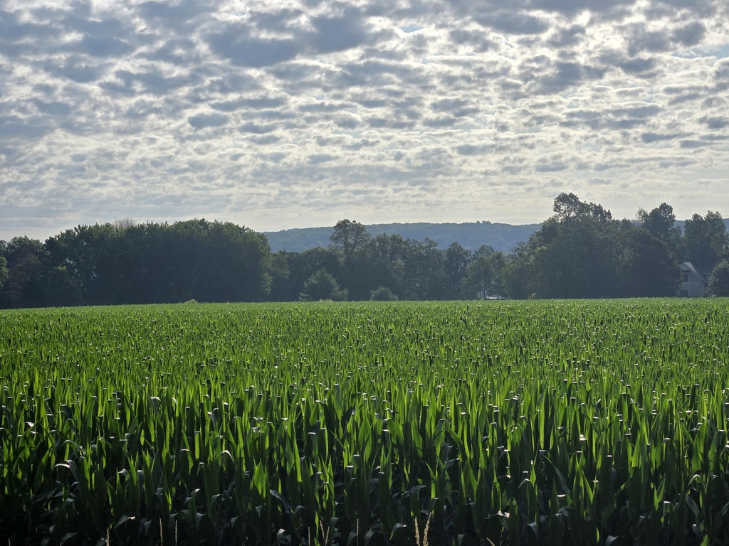
We had about 10 miles to ride inside Minnesota before reaching the border with Wisconsin. Minnesota roads were not as nice as South Dakota, but the people were fantastic. We had multiple people stop by our campsite last night for a chinwag. We had some nice farm views this morning – being off the cycle paths was nice from that perspective. The farm views were about the same in Wisconsin as they were in Minnesota, though we did come across a nice looking vineyard in Minnesota.

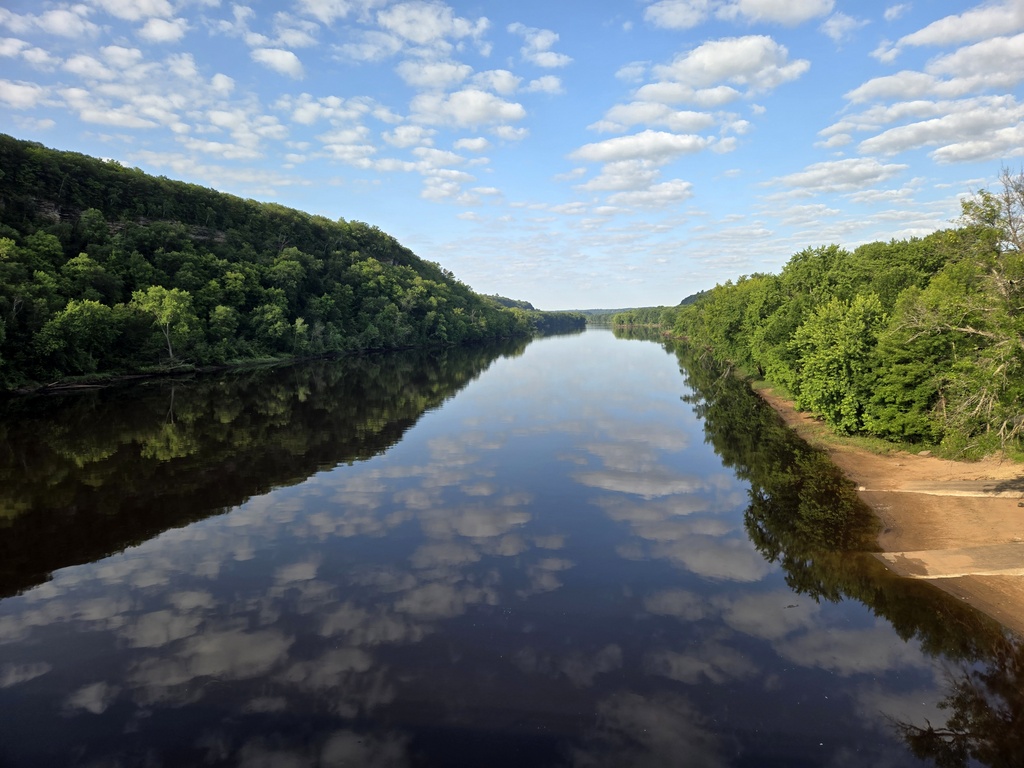
We had nice views of the St Croix River as we crossed into Wisconsin. Neither Nancy nor Chris stopped for river or state line photos (Senior editor’s note – the state sign was part way up a steep pitch with no shoulder, so I really didn’t see the need to stop right there). They have pretty much delegated photographic duties 100% to me at this point in the trip. I have to sprint to catch back up with them but today I knew we’d be pulling into Osceola, the border town shortly after and we’d meet up again there today – there was no need for me to time-trial back to them.

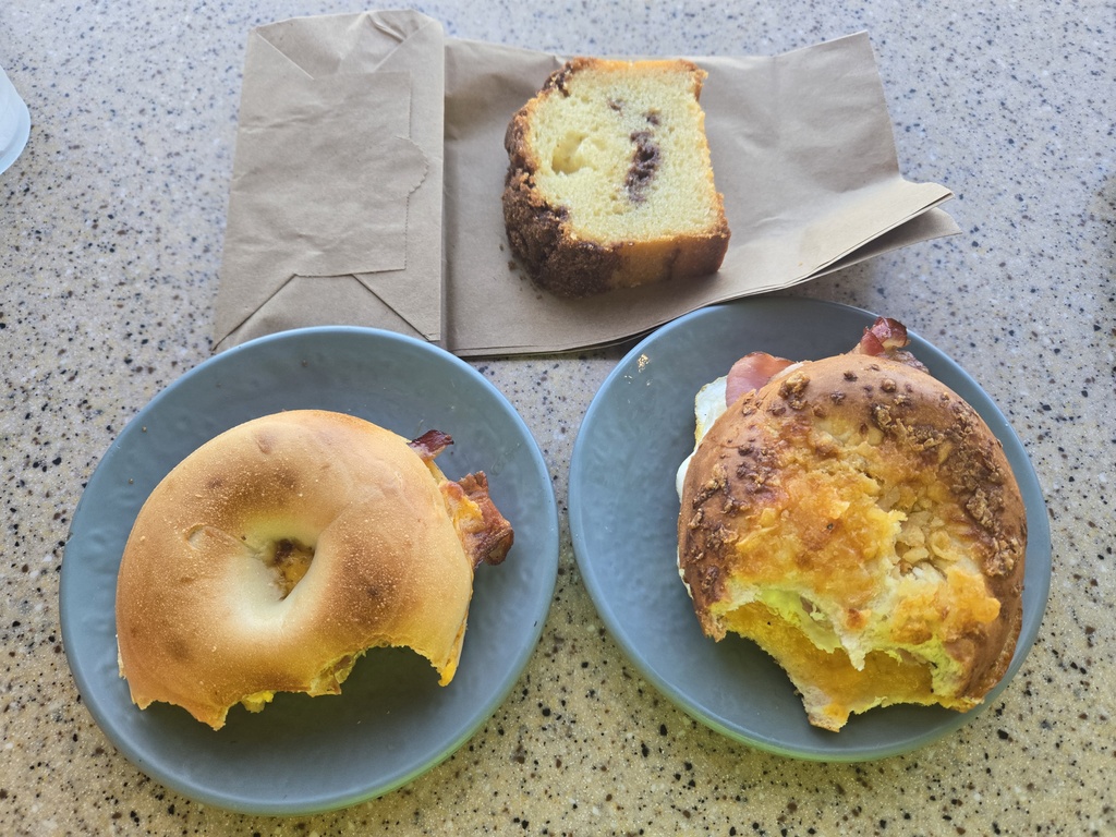
After 10 easy miles, we stopped for a second brekkie in Osceola. We did not need a second brekkie but we weren’t sure what we’d find from there to Cumberland, our planned stop for the night, and didn’t want to be caught undernourished. Nancy and I shared a brekkie bagel; Chris had a lumberjack to himself. Neither Chris nor Nancy could wait for me to return from the gents to get a nice, blog worthy food photo – so all you get is the following.

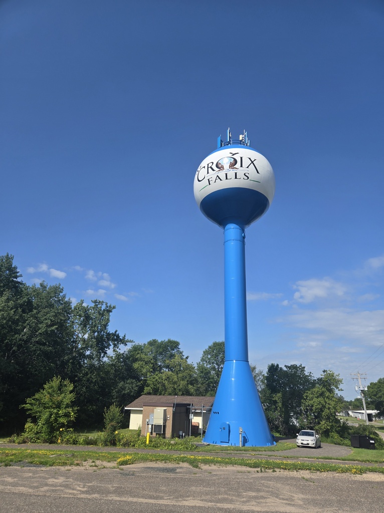
We had some nice Adventure Cycling back roads onwards to St Croix Falls and from there, we hopped on the Gandy Dancer cycle path. We rode this path for about 5 mostly uphill miles, just enough to get a traffic break, but not enough to make us miss the wide open country-side views. We ran into an older couple on e-bikes and raced them to the top. We won, but I don’t think they were really trying.
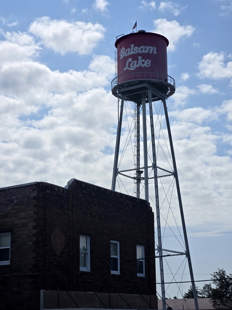
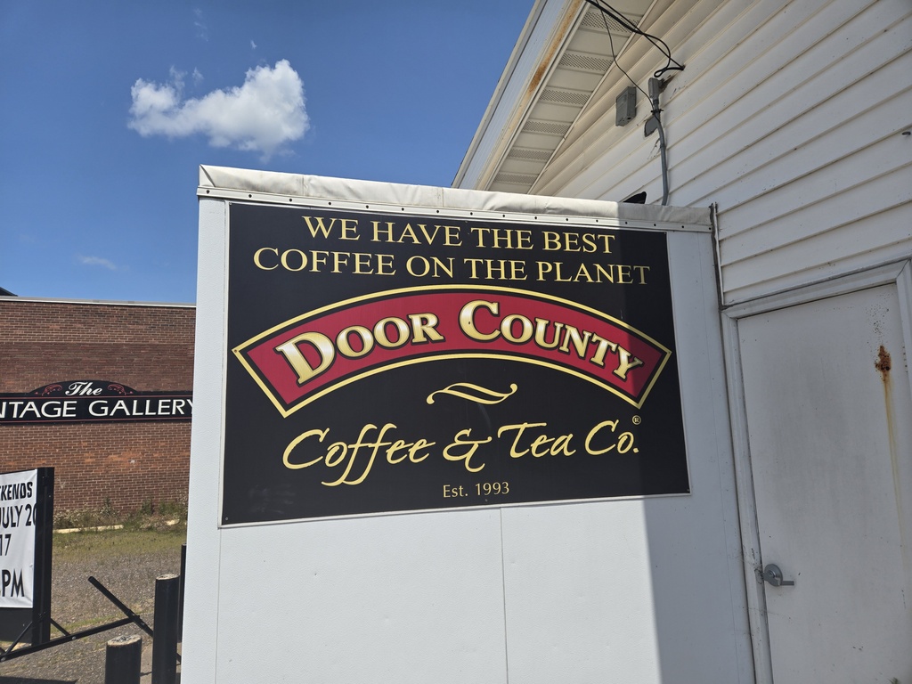
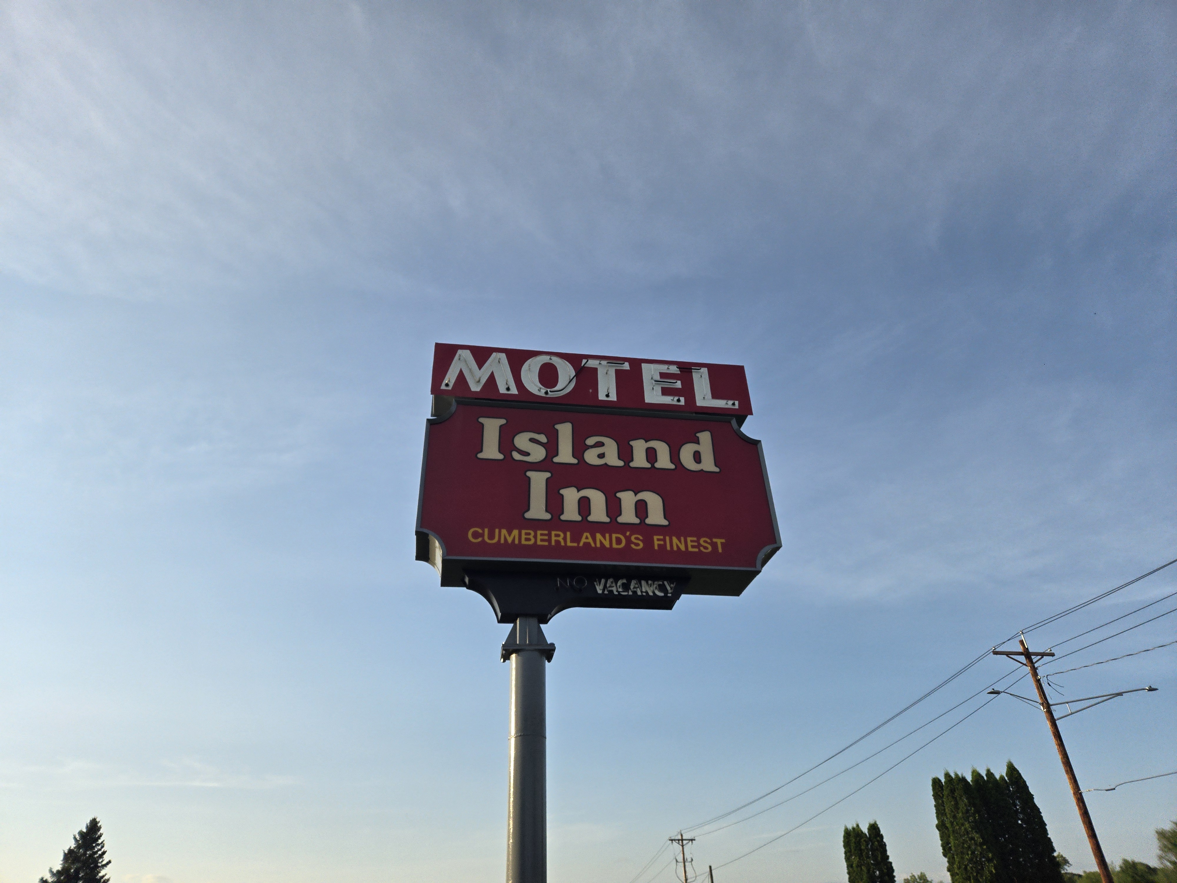
More farm back roads led us to the nice looking town of Balsam Lake where we found a store, a cafe and several restaurants – it had a real touristy vibe. One of the locals told us that the nearby lake had 800 cabins around it, so it sounds like it is a popular vacation spot. So much for needing that second brekkie in Osceola. We stopped for a lemonade and snack before the last push into Cumberland for a late lunch. Lunch was taken at Peter & Annies Cafe. They serve Door County Coffee, which makes the claim that they have the best coffee on the planet so we sort of had to stop. Their sandwiches were nice. Their coffee was good but after a single cortado, I’m not quite ready to agree that it is the Planet’s best.

Leaving lunch, Nancy had a flat rear tire. Bummer, only 1.3 miles from our hotel. She walked her bike to the grocery store and I pumped it up there. She was able to ride it to the hotel. I’m happy to report that this time, I found the pesky wire that caused the flat. In fact, this time, the wire had worked its way through my last patch and the tube. I really looked hard for the wire last time I fixed her tire but couldn’t find it. Today, I got the little bugger.
Aside from crossing into our 7th state today, the other major milestone was Chris completing his second day as a junior navigational trainee on the Chris Crossing team. He’s had his phone on his new mount for two days in a row and I would cautiously offer that Nancy and I could have possibly had our GPSs switched off both days. We didn’t say that we are ready to turn the GPSs off, just that we may not have ended up in Canada had we followed Chris’s lead entirely. When we exited the lunch coffee shop, I asked him to tell me which direction was north, without looking at his phone – he was a little shaky on that one.

Bottom-line: anyone like Chris with self professed navigational challenges can improve their skills almost overnight simply by using a GPS or smartphone. Well done Chris – tell us when you think you’re ready take the lead. Note however, Nancy will never really turn her GPS off and you know by now, she’s a checker. So, by lead, I mean joining my club as a pseudo leader while not so secretly Nancy remains the official navigational team boss.


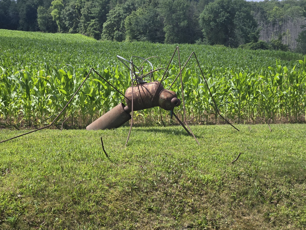
Terrifying. I brought 2 bottles of bug spray, but I think I’d need something a lot more powerful for that bugger.
Good news, limited mozzies in Hayward. We heard that they were bad here.
ohhhhh…it is letting me comment on my phone again! How are the mosquitos in Wisconsin? I’m impressed that you two can share one breakfast sandwich. Pete and I don’t do that very well. The scenery looks quite nice.
No mozzies in Hayward, yeah.
AH ah you’ve entered my old home state of WI, (up until @1976) hope you enjoy your time there.
That’s almost 50 years, wow!
That photo of the St Croix River is one of the most beautiful so far.
And the rest of the team wouldn’t stop, crazy!
Enjoying the daily updates, stories and photos, keep on cycling!