Written by Dave
Takamori (Kyukamura Autocamp) to Hinokage – (58k, 726m)
Our night glamping was a bust. We tried using our double sleeping bag over the provided deluxe air mattresses. There were two fundamental flaws with this strategy. First, they were inflated to different levels, meaning an uneven bed. Second, our sleeping bag put us right over the joint of where the two mattresses came together and they were slippery, meaning we ended up both sliding down between the two mattresses as they moved.
Aside from the mattresses, as the night passed more things not working were added to the list of failed services. The bathrooms were not close to clean, the legs of the wood benches for our table picnic table were rotted by termites and there were no paper towels or soap in the bathrooms. We moved on this morning more than happy to get away. Funny, Nancy received one of those “tell us how we did” emails from them this afternoon – sigh. Anyway, if you are planning to stay there I’d say just sleep in your own tent and don’t pay for any extras.
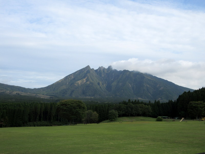
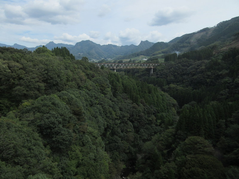
Leaving camp we had a couple choices for routes up and over some small mountains south of Mt Aso. On the map we could see that they both reached the same high point. One was a squiggly line of gnarly looking switchbacks, the other clearly the new road much straighter and probably shorter overall. I was keen to try the old road, Nancy, not so much.
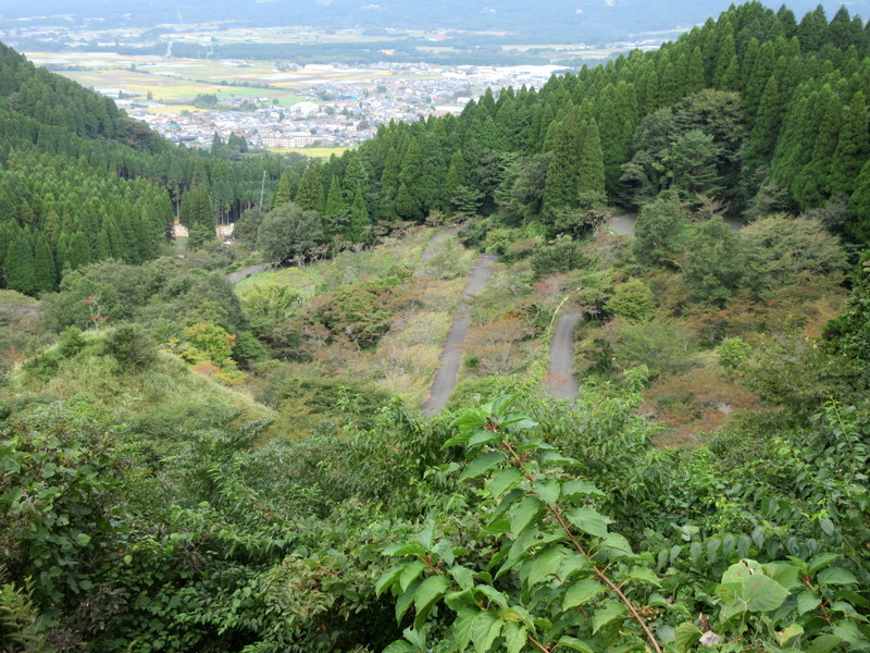
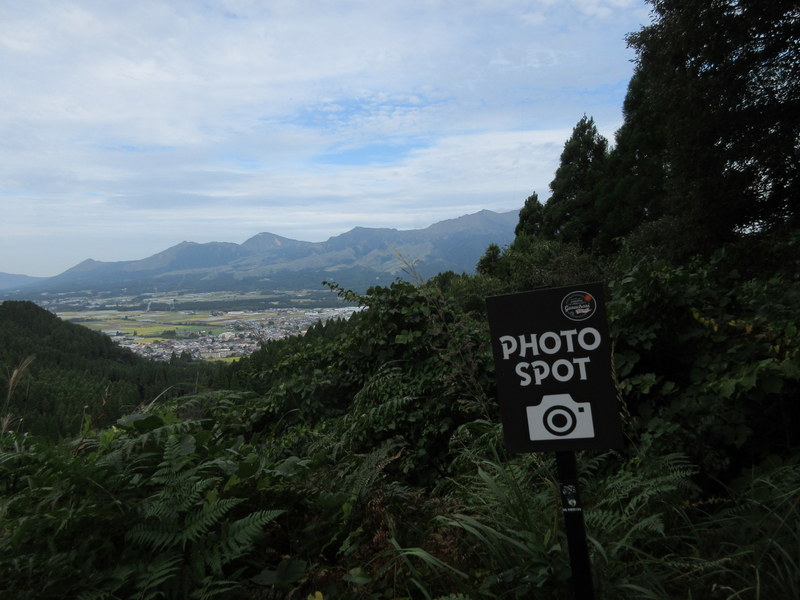
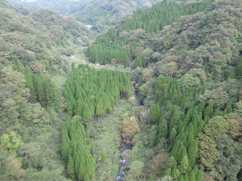
We agreed to ride the last cut-off point and have a look at the old road. At the cut-off, we could tell that the road was disused but more or less rideable, so Nancy agreed to give it a go. Wow, what a road it turned out to be. No cars passes us and the switchbacks were crazy coming back on themselves several times. The best part was the vegetation – clearly the road was being given back to Mother Nature with weeds now covering the entire painted fog line. We had some nice views of Takamori town and Mt Aso but mostly we saw tall weeds. We rode on hoping that the road was not closed ahead. It wasn’t and as “planned” we joined the new road at the summit – phew that was fun/lucky.

At the summit, there was a 1k uphill tunnel but traffic was light and we rode time trial mode up and only had a couple cars pass us. From the tunnel exit for the rest of the day it was way more downhill than uphill. A couple times we hit 1st gear uphills but they were all short and we blazed along otherwise.

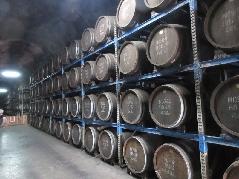
As we neared Takachiho, where we planned to stop for supplies, we came upon a michinoeki that doubled as a sake cellar. They were using an old disused road tunnel to store barrels of ageing sake. We are not big sake drinkers but the smell waifing form the tunnel was very interesting – sort fermenting rice mixed with whiskey. When intermixed with the smell of BBQ chicken they were frying up out from, we didn’t know if we were coming or going.
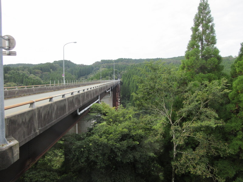
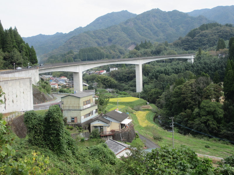
We stopped for supplies in Takachiho as planned but then were sort of unsure which route to ride next. It was only about 12k to our planned stop and clearly there were a series of new roads and an expressway built way above the famous Takachiho Gorge. It would have been completely straight forward to ride one of these roads (not the expressway, obviously, as bikes are not allowed on them). But, no, we were not in straight forward mode today – right Nancy!? Plus Komoot said to dive deep into the gorge as well, so that’s what we did.

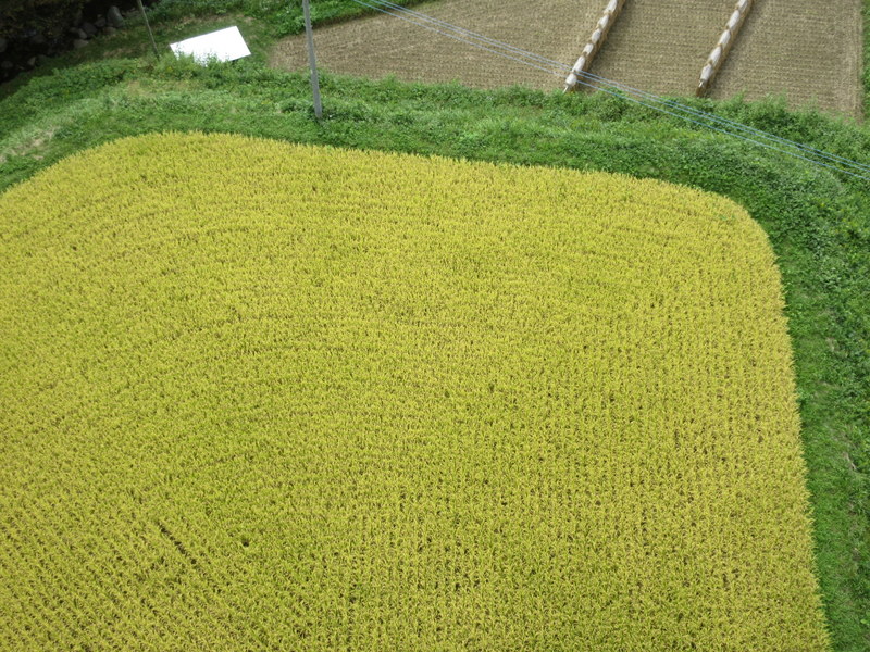
A couple K from town, Komoot suggested a yellow road that led us down into the gorge. As this point I have give Komoot credit as the road did go to the river, but how that was a yellow road is beyond me. It was so steep that both of use had screaming brake as we descended. We were hanging on for dear life, hoping that the brakes would hold. They did, but boy there is no way we’d ever make it back up that if this turned out to be the wrong road.
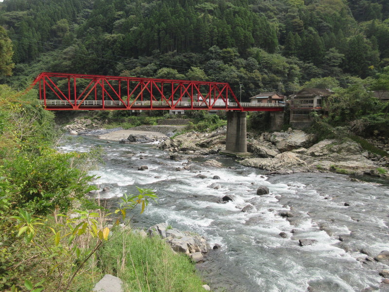

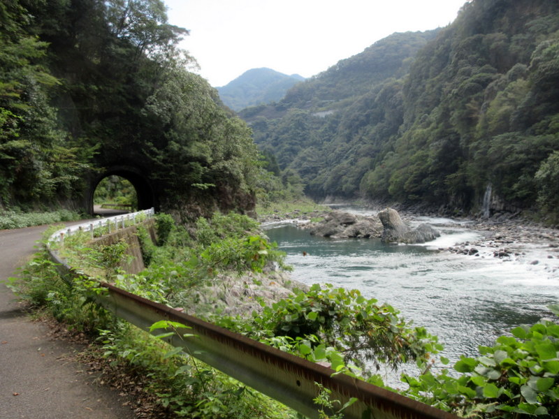

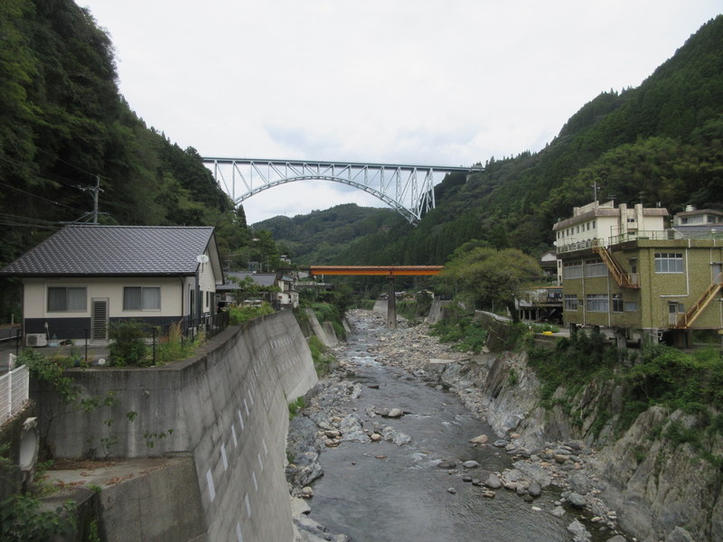
For the first 5k in the gorge we loved it. Takachiho Gorge is known worldwide for famous photos of narrow rock overhangs and raging rivers. We didn’t see too much of this but we saw zero cars, some crazy steep walls on both sides and a raging blue river off to our right. It was magical downhill riding. Then came the shocker. 5k down river from a hill we could never ride up, we came across a sign that said road closed ahead due to rock slides. Wow, what to do. There was a bridge across the river here and a road on the other side of the river but it involved some back tracking and we weren’t sure if it went through either.
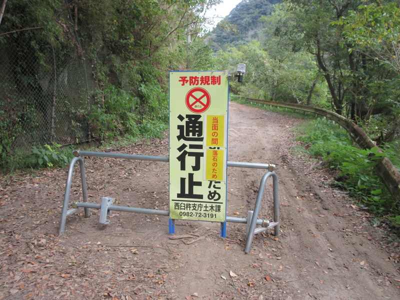
We decided to try riding through the closed road sign to see if we could get through on bikes. It was only maybe 500 meters but unfortunately, it was probably only passable if you were walking, without a bike. We couldn’t even unload the bikes and porter them across.
So, back to the closure sign we rode. We decided to give the bridge a go. From reading the map it was only 5 turns up to meet the road going down the other side of the gorge. Well, this was true but we were 100 feet below the bridge when we met it with no way to get on it. We had to keep riding way past the bridge and double back.
All this was on steep roads where we were never really sure it would work. I was relieved to reach the top and knew we only had to ride down river more. Nancy, being a little flustered by all the re-routing and now being “off piste” on her Wahoo, was more concerned about what way we should go. Eventually I convinced her that it was all good and that google maps would get us home. We rode the last 6k without issue, but with a couple stops to be doubly sure we were on the right route. What an adventure!
We arrived at Hinokage and our planned stop for the night – phew, I’m I glad that worked out! We had to be here to check in before 5, and there were a few concerned glances at the watch after we had to turn around at the closed road sign.
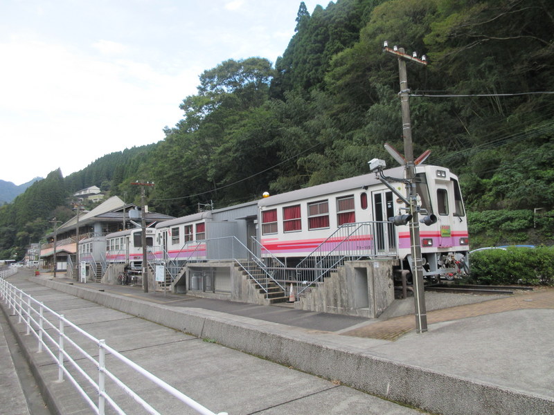
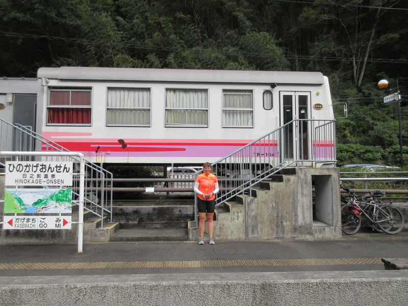
We are staying at the end of a disused train line in Hinokage. In the true spirit of “life give you lemons, make lemonade”, the good folks of Hinokaje lost their train service and turned a potentially bad situation into an opportunity. At the station, they have parked 4 train cars and converted them into lodging. They converted the station into an onsen and restaurant. Now, instead of derelict buildings, they have jobs and a nice tourist attraction.
We’ve had our bath in the onsen and are now thinking about getting some dinner. It was a great day for a bike ride. As they say, you are never really lost, you are just on an alternative route. Right Nancy, now where did she go? She was here just a minute ago….. (Senior editor note – hahaha, that joke is getting old now Dave…).

like that train car converted to lodging idea!
Me too. And having them make something of a bad situation was cool.
The “Photo Spot” sign was only in English. Perhaps only the foreigners need to be told when to take pictures? Or maybe only foreigners now use the old road. Take a photo of the interior of your train car lodging. It looks interesting.
Pretty good adventure! Great PHOTOS! A few of the train car interiors would be great.
See next day, train car photos are about all we got!
I would love a train car stay! Looks fun!